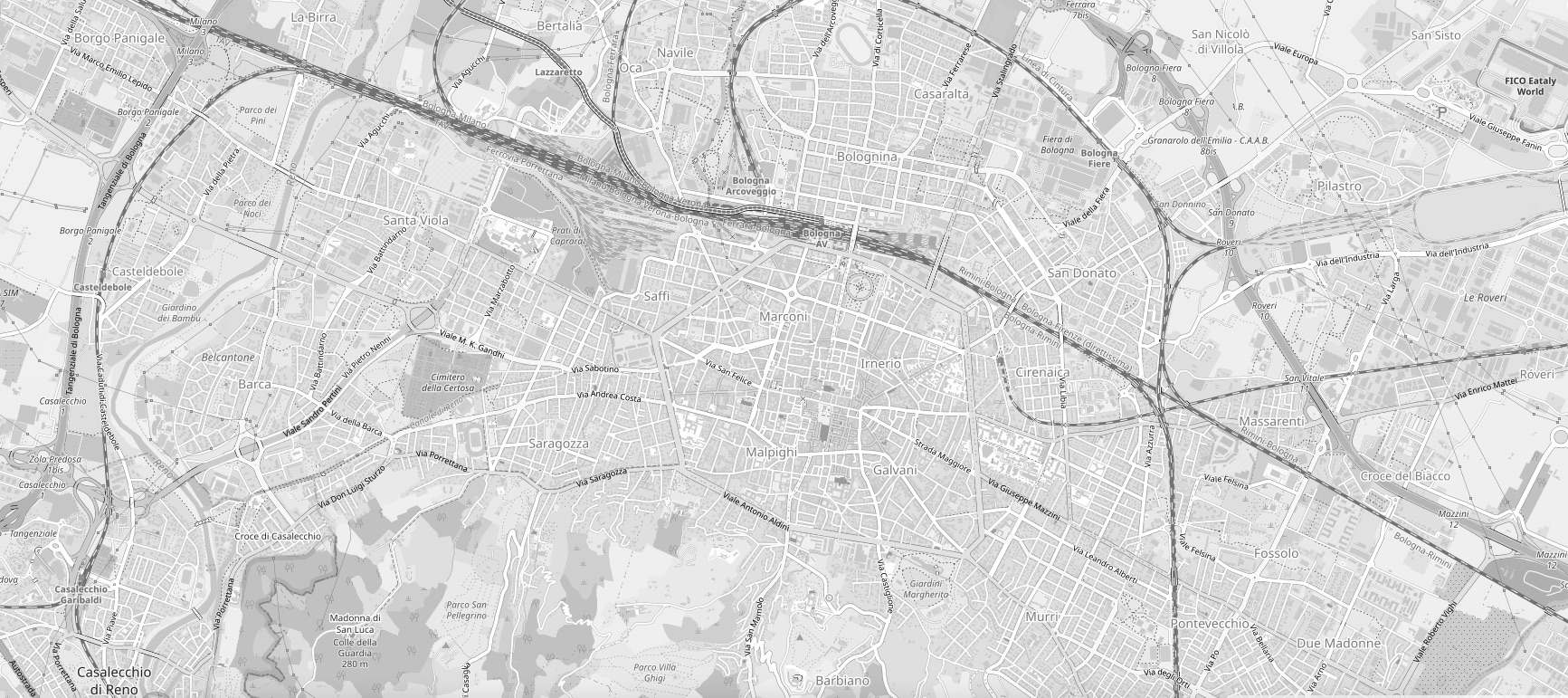
When in Bologna you are either dentro or fuori porta (inside or outside the city gates). The once intact ancient wall is now encircled by the viale (ring road). Life dentro porta means arcades, monuments and charming architecture. Just about everything is within walking or biking distance. It also means higher density living, steep rent and minimal green space. Depending on where you land, fuori porta can mean urban sprawl minus the charm, fancy suburbs with beautiful parks and everything in between. Keep in mind that Bologna has good bus service and nothing is ever too far away.
For a list of quartieri, see the section City Neighborhoods in Plugging In.

© Image from OpenStreetMap modified by IWF Bologna
CENTRO STORICO
The center is characterized by a labyrinth of narrow streets and arcades. The university district, with its heart in Via Zamboni, is packed with students day and night. This area is very lively, with lots of bars and eateries, but it also attracts a seedy element that may not be attractive to families. The area running from Piazza Maggiore towards Santo Stefano, Castiglione and San Mamolo is residential, quiet and beautiful.
BOLOGNINA/CORTICELLA
These areas are located on the north side of the city. Bolognina, or “Little Bologna,” is situated right behind the train station and runs eastward toward the fiera (convention center) district. The heart of the area is Piazza dell’Unità, well-serviced by public transportation. A former working-class stronghold, this area is increasingly home to immigrants, young families, students, artists and older people, which makes for an eclectic mix. Bolognina borders Corticella, an area with a similar demographic, but characterized primarily by 1960/70s block architecture. Corticella is the first stop on the north-bound commuter train and also has a small park and lake.
BARCA/SAFFI/BORGO PANIGALE
Via della Barca runs westward from the soccer stadium. The Barca neighborhood includes the area off via della Barca and the Reno area, named for the Reno river which cuts through it from south to north. Bus service is good, but the walk to a bus stop may be a little long. This is primarily a residential area with tall apartment buildings and a nice greenbelt along the river. Via Saffi is one of the main arteries leading out of the city and turns into via Emilia Ponente, where one of the city’s largest hospitals, Ospedale Maggiore, is located. Westward from Saffi is Borgo Panigale, home to Ducati and other industries. Recent construction has somewhat revitalized this traditional working-class neighborhood. A word about the Via Emilia, the ancient east-west route that runs across Emilia Romagna. Locals often direct you to the Via Emilia, but this roadway actually has many names. In the city, you should know that via Emilia Levante (rising) heads east and via Emilia Ponente (setting) heads west.
MAZZINI/MURRI/SAN RUFFILLO
Heading outward from Porta Mazzini and Porta Santo Stefano, this residential area extends into the hills and includes some high-end neighborhoods. Many of the homes along the area’s tree-lined avenues are constructed in attractive stile bolognese (Bolognese style). One of the city’s largest and nicest parks, Giardini Margherita, is at the entrance of Via Murri. The area has many shops and supermarkets, as well as cinemas and the Sterlino swimming pool.
SAN DONATO/MASSARENTI
These areas extend outside Porta San Donato and Porta San Vitale. Heavily trafficked via Massarenti is home to the university hospital, Policlinico Sant’Orsola/Malpighi. Excellent bus service makes it accessible to the city center, it is also serviced by the little-known suburbana train that runs from Crespellano to Budrio. Traditionally a working-class area, San Donato’s more reasonable prices make it popular for students. The fiera district is located here.
COLLI/COSTA/SARAGOZZA
When someone tells you they live “in the colli,” it really means they live anywhere in the exclusive hilly areas on the south side of town. Some call this the Beverly Hills of Bologna. The air in the colli seems cleaner than in the rest of the city, the temperature is lower all year round and there are some amazing views. On the other hand, it is not always well-served by public transportation and many of the narrow streets have limited parking. One of the highlights of the area is the Parco Villa Ghigi, which is accessible from Via San Mamolo by foot or bike, or from Via Gaibola. Bologna’s soccer stadium lies between Via Andrea Costa and Via Saragozza, both conveniently close to the center with plenty of shops, theaters and services. From Via Saragozza, one can make the historic pilgrimage up the 666 porticoed stairs to the Basilica di San Luca, a major Bologna landmark.
JUST OUTSIDE
The following areas are not in the administrative jurisdiction of Bologna and have their own comuni. From the north moving clockwise, they are: Castel Maggiore, Granarolo dell’Emilia, Castenaso, San Lazzaro di Savena, Casalecchio di Reno, Zola Predosa and Calderara di Reno. Given their proximity and accessibility via public transport, many consider San Lazzaro di Savena and Casalecchio di Reno to be extensions of Bologna neighborhoods.

